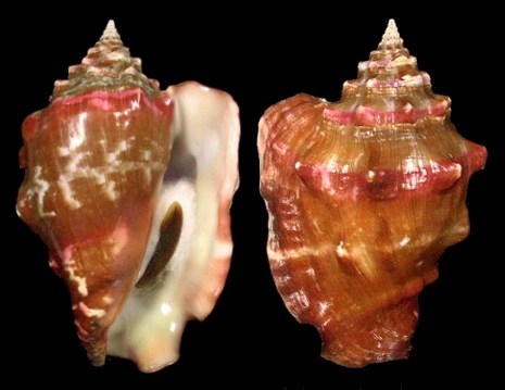
Strombus bubonius.
Determining the position of past coastlines is not straightforward. The location of the shoreline depends not only on the sea level, which increases or decreases in function of the amount of the oceanic water (eustatic factor), but also on the intrinsic level of the soil, which rises or lowers for glacio-hydrostatic and tectonic factors.
The land areas of the continental plates are substantially solid plaques floating as rafts on the earth fluid mantle. The height level of these plaques depends on two factors:
a) the glacio-hydrostatic factor, due to the weight of glaciers and sea water insisting on the plaque. That a glacier makes heavier the raft on which it sits is intuitive. Less intuitive is the fact that the edge of the plate usually does not coincide with the shoreline, but typically extends into the sea. This means that in order to assess the total weight burden on the plate, also the water insisting on the submerged part of plaque must be taken into account. The total weight, thus calculated, determines the "waterline" of the plaque on the mantle;
b) the tectonic factor, instead, is due to the fact that sometimes, at the junction, one plaque slowly surmounts the other. In these conditions, the soil of the first rises while that of the second dips.
Discerning among the three movements is complicated. But, under certain conditions, the contributions of the various factors can be separated. For example, since we know that during the penultimate interglacial (120,000 y. ago) the amount of water in the oceans was the same as today, the eustatic factor between now and then is zero. Thus, if we find the coastline of that time, its displacement from today’s would be due to the other two factors only.
In geology, the shoreline position of one hundred and twenty thousand years ago is called Marine Isotope Stage (MIS) 5.5 , and can be found by means of some marine organisms which, by living only at sea level, leave their shells to signal it. In the Mediterranean, the preferred marker is the Strombus bubonius, a tropical mollusc which normally lives on the coast of West Africa, but during the warm interglacial periods crosses the Strait of Gibraltar and colonize our sea. The dual characteristic of living within a few meters from the sea level, and to be absent during the Ice Ages, makes this shell a perfect witness of the shores of a hundred and twenty thousand years ago.
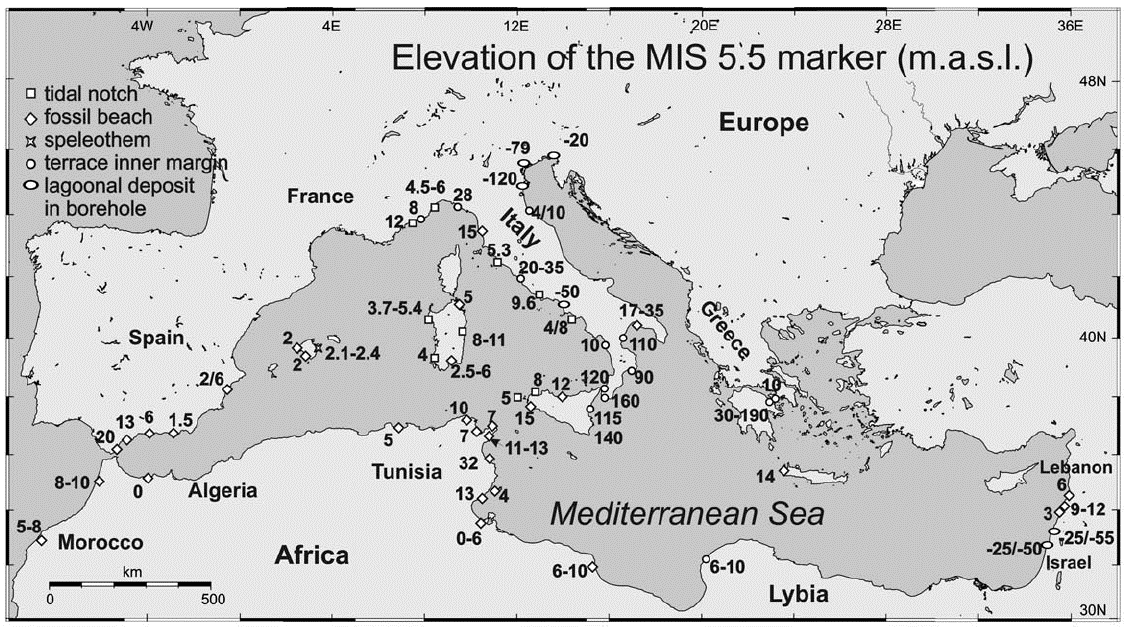
Along the coasts of Tunisia and Libya, the average height of the MIS 5.5 on the current sea level is comprised within 15 meters, the same value measured in western Sicily between Erice and Mazara (Ferranti et al., 2006). In Lampedusa, in the middle of the Strait of Sicily, the MIS 5.5 is at sea level. Along the southern coast of Sicily markers have not been found, probably because the friability of the coast itself prevented preservation (Antonioli et al., 2006). Since, even at the peak of the Ice Age, Sicily stayed without glaciers (meaning a glacio-hydrostatic factor equal zero), Strombus findings prove the tectonic tranquillity of western Sicily and Tunisia.

The cases of eastern Sicily and Pantelleria are different. Pantelleria is a volcanic island, still subject to an intrinsic assessments producing complex movements on its coasts. Nevertheless, these movements are essentially local and about fifty miles away from the island they are substantially dampened. Along the eastern coast of Sicily tectonic movements are very pronounced. The ionic eastern coast coincides with a fault where the Sicilian plaque meets the Calabrese one, generating extended frictions. However, the large values of MIS 5.5 of the ionic Sicilian side do not reverberate on the southern part of the island, because the latter is separated from eastern Sicily by the fault of Scicli. In these conditions the reasonable conclusion is that, south of the Scicli fault, the plaque is rigid and the southern coast of Sicily behaves like the western one.
In conclusion we can say that, except for Pantelleria and some possible submerged volcanoes, the region of the Strait of Sicily was hydrostatically and tectonically quiet during the last Ice Age and the shoreline moved only for the eustatic factor.
In other words, in the last twenty thousand years, the Strait of Sicily has been stable and the topography has changed only for the increase in sea level. This means that the map derived from the batigraphy is substantially correct. As Monsieur de la Palisse would have said: when the sea level was eighty meters lower, everything shallower would have emerged.
Antonioli, F., S. Kershaw, P. Renda, D. Rust, G. Belluomini, M. Cerasoli, U. Radtke, S. Silenzi. (2006) Elevation of the last interglacial highstand in Sicily (Italy): A benchmark of coastal tectonics. Quaternary International 145–146, pp. 3–18.
Ferranti L., F. Antonioli, B. Mauz, A. Amorosi, G. Dai Pra, G. Mastronuzzi, C. Monaco, P. Orrů, M. Pappalardo, U. Radtke, P. Renda, P. Romano, P. Sansň and V. Verrubbi. (2006)Markers of the last interglacial sea-level highstand along the coast of Italy: tectonic implications. Quaternary International 145-146, pp. 30–54.
Dal 2012 ci sono stati accessi al sito;
Atlantide č stata visitata volte.